Six Days in Kings Canyon

lambertiana

Gold Member
Joined
Jul 7, 2000
Messages
9,538
I just got back from a six day backpacking trip in the high country of Kings Canyon NP. We started at Onion Valley and went over Kearsarge Pass. On the way up we passed Heart Lake
KingsCanyon2009702.jpg


And Big Pothole Lake
KingsCanyon2009041.jpg


When we got to Kearsarge Pass, we had good views toward Kearsarge Lakes, our destination for the day
KingsCanyon2009050.jpg


Our camp at Kearsarge Lakes
KingsCanyon2009134.jpg


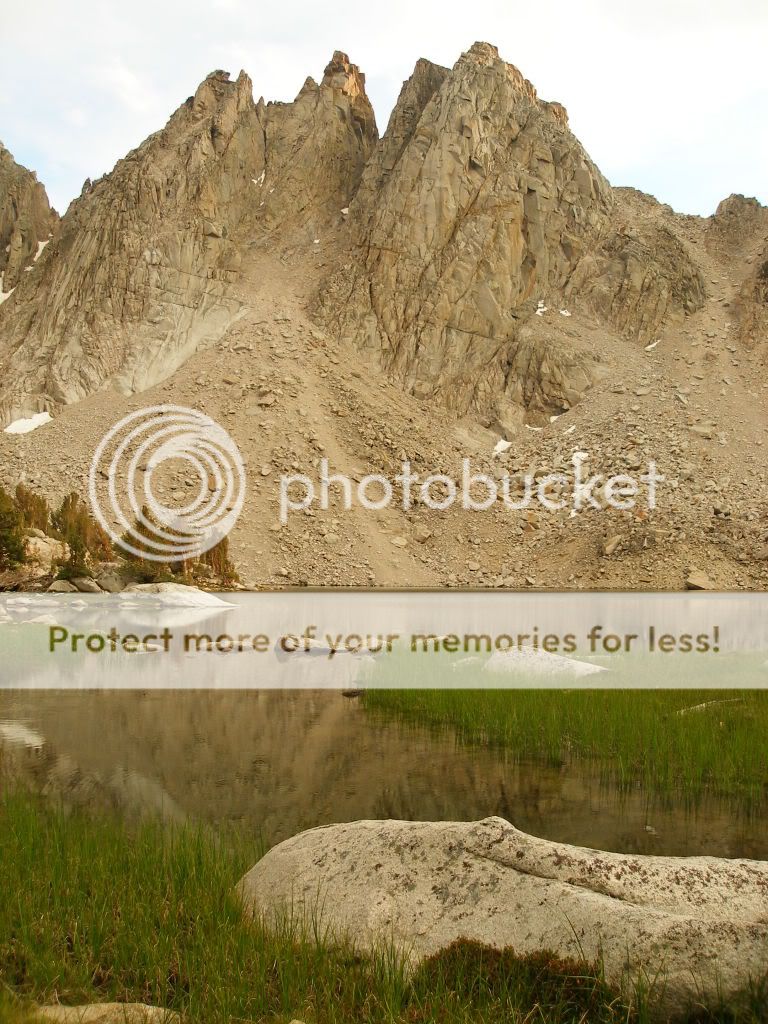
Here are some views around Kearsarge Lakes

KingsCanyon2009580.jpg


KingsCanyon2009559.jpg
 
The next day we started toward Rae Lakes. On the way we passed Bullfrog Lake:
KingsCanyon2009540.jpg


KingsCanyon2009536.jpg


As we got close to Glen Pass, my son continued to have serious problems with AMS, so while most of my friends went on, I turned back with my son and his girlfriend and went down toward Charlotte Lake:
KingsCanyon2009511.jpg


KingsCanyon2009234.jpg


KingsCanyon2009239.jpg


KingsCanyon2009243.jpg
 
The next day I did a little exploring, and went to the top of the ridge to the south of Charlotte Lake, and had great views to the south towards the Bubbs Creek drainage
KingsCanyon2009275.jpg


And I visited a small lake in a bowl under Mt Bago
KingsCanyon2009300.jpg


The next day I took a dayhike over Glen Pass to visit Rae Lakes, here are some views of the area
KingsCanyon2009366.jpg


KingsCanyon2009394.jpg


KingsCanyon2009415.jpg


KingsCanyon2009439.jpg
 
Last edited:
Looking south from Glen Pass
KingsCanyon2009469.jpg


A couple little ponds on the south side of Glen Pass:
KingsCanyon2009482.jpg


KingsCanyon2009488.jpg


The next day we went back out to Kearsarge Lakes to spend our last night there:
KingsCanyon2009654.jpg


KingsCanyon2009141.jpg


Another picture taken near Bullfrog Lake:
KingsCanyon2009521.jpg


And the obligatory knife content, this was what I had with me:

KingsCanyon2009504.jpg
 
great pics as always John... How were the those pesky blood suckers??? were they out in force... How many miles did you cover over all??

Sasha
 
Stunning. Looks like the weather was with you. How they managed to keep that place pristine is beyond me.
 
Nice pics! Spectacular scenery.

Why do you carry all those knives with you?:confused:

;):D

Kind regards,

Jos
 
That looks like it was an awesome trip! Thanks for sharing the pics with us!
 
Amazing pictures!! I'll have to keep looking at these a bit. I think I'd like to spend about a month at that Bullfrog lake!!
 
Great pictures. Looks like that trip didn't suck. Nice Laconico BTW.
 
I too would like to know how far you went and how long you were out. Thanks for sharing some great pics!
 
Really nice picture of a really interesting area. Just about the time that all that snow melts, it'll start again. What's the elevation there?
 
Mileage for this trip was less than what I usually do, I think I totaled about 35-40 miles. It was all high, the lowest point was the trailhead at Onion Valley (9185'). Our camp at Kearsarge Lakes was at 10,900', Charlotte Lake is 10,370', and Rae Lakes is 10,500'. I live at sea level, so it was thin air for me.

The mosquitos were out in force, I think this is the worst year for them in a long time.

Bullfrog Lake is a very nice spot, but it was being loved to death and camping is not allowed there any more. It is one of the few locations in Sequoia/Kings Canyon where you can't camp.

It is kept relatively pristine because of two factors: First, it takes a pretty stiff hike just to get there, which weeds out a lot of the people who do not respect wilderness. And second, entry at the trailheads is limited by daily quota. Nonetheless, it was more crowded than I like, we saw other people every day.

I carry all those knives because I can.
 
That is some beautiful country, and some great pics of it:thumbup:
 
Back
Top