- Joined
- Jul 21, 2018
- Messages
- 2,150
The BladeForums.com 2024 Traditional Knife is available! Price is $250 ea (shipped within CONUS).
Order here: https://www.bladeforums.com/help/2024-traditional/
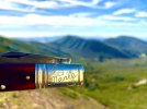
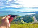
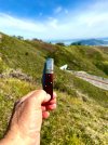
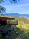

My wife had President’s Day off but thats not one I get so I had to take a vacation day so that we could go on a hike together. We hiked up and on the ridge that separates the SF Bay from the Pacific on the southern end of Marin Peninsula.
Looking southwest at Marin Headlands:
View attachment 2090188
Little farther along, Pacific in distance:
View attachment 2090203
Looking southward at Golden Gate Bridge and San Francisco as we approached dip in ridge:
View attachment 2090209
Turning to more easterly view with Robin Williams Tunnel along Interstate 101 and Angel Island at mid-right:
View attachment 2090225
…and then northward at Mt Tamalpais.
View attachment 2090228
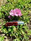
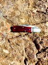
…and some action shots, we had a series of bomb cyclones a few weeks back that dumped rain on us for a week or so but now with the warming weather the wildflowers are coming out:
View attachment 2090229View attachment 2090230View attachment 2090231
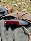
…and then this little unofficial “scientific station” (more like a drinking/smoking spot) where Merle joined the other trinkets in the shrine:
View attachment 2090232
Great photos my friend . When you were taking the photo looking toward the Golden Gate , you were just south of the old U.S. Army Long Range Acquisition Radar site Gertie . And toward the North on Mt. Tam , the Air Force also had one .My wife had President’s Day off but thats not one I get so I had to take a vacation day so that we could go on a hike together. We hiked up and on the ridge that separates the SF Bay from the Pacific on the southern end of Marin Peninsula.
Looking southwest at Marin Headlands:
View attachment 2090188
Little farther along, Pacific in distance:
View attachment 2090203
Looking southward at Golden Gate Bridge and San Francisco as we approached dip in ridge:
View attachment 2090209
Turning to more easterly view with Robin Williams Tunnel along Interstate 101 and Angel Island at mid-right:
View attachment 2090225
…and then northward at Mt Tamalpais.
View attachment 2090228
…and some action shots, we had a series of bomb cyclones a few weeks back that dumped rain on us for a week or so but now with the warming weather the wildflowers are coming out:
View attachment 2090229View attachment 2090230View attachment 2090231
…and then this little unofficial “scientific station” (more like a drinking/smoking spot) where Merle joined the other trinkets in the shrine:
View attachment 2090232
Harry, yes, there were the radar sites there including a base up on Tam itself…my barber (since retired) was stationed up there. There are also the Nike Missiles site at Ft Barry plus all the gun batteries built around the Gate that go back through the World Wars and actually back to Civil War when the US was concerned about Confederate ships trying to steal the precious metals coming out of California and Nevada. I seem to recall in some long ago post of yours about serving on Mt Tam.Great photos my friend . When you were taking the photo looking toward the Golden Gate , you were just south of the old U.S. Army Long Range Acquisition Radar site Gertie . And toward the North on Mt. Tam , the Air Force also had one .
Harry
I was in the Army and was on Gertie . There were Nike Missile batteries around San Francisco and many other Major U.S. cities . The U.S. Army controlled the missiles then and had the Ajax missiles then ( 1958 & 1959 ) and later went to the Hercules then I do not know what they went to after 1961 . I transferred to the Cincinnati area , which they were starting up , in late 1959 . I eventually went to a radar site around the city but was in Indiana which was only 30 miles from my home . All the missile sites that I knew of then have been closed down for a number of years . That was a long time ago but I still have memories that come floating back .Harry, yes, there were the radar sites there including a base up on Tam itself…my barber (since retired) was stationed up there. There are also the Nike Missiles site at Ft Barry plus all the gun batteries built around the Gate that go back through the World Wars and actually back to Civil War when the US was concerned about Confederate ships trying to steal the precious metals coming out of California and Nevada. I seem to recall in some long ago post of yours about serving on Mt Tam.
Really enjoying your pics MarkMy wife had President’s Day off but thats not one I get so I had to take a vacation day so that we could go on a hike together. We hiked up and on the ridge that separates the SF Bay from the Pacific on the southern end of Marin Peninsula.
Looking southwest at Marin Headlands:
View attachment 2090188
Little farther along, Pacific in distance:
View attachment 2090203
Looking southward at Golden Gate Bridge and San Francisco as we approached dip in ridge:
View attachment 2090209
Turning to more easterly view with Robin Williams Tunnel along Interstate 101 and Angel Island at mid-right:
View attachment 2090225
…and then northward at Mt Tamalpais.
View attachment 2090228
…and some action shots, we had a series of bomb cyclones a few weeks back that dumped rain on us for a week or so but now with the warming weather the wildflowers are coming out:
View attachment 2090229View attachment 2090230View attachment 2090231
…and then this little unofficial “scientific station” (more like a drinking/smoking spot) where Merle joined the other trinkets in the shrine:
View attachment 2090232

Thanks Jack, it’s been fun to have Merle and share my home with the Porch.Really enjoying your pics Mark
Tasty looking beverage. What is itSausalito for late lunch, wife and I meeting our daughter and her boyfriend.View attachment 2095735View attachment 2095736
The patina on the blade has come along real nice.
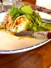
Just a couple of Henhouse (Petaluma Brewery) Hazy IPAs but we were getting some alpine glow conditions (refracted sunlight off cloud cover often amplified when bounces back off calm surface of Bay) which might have been having an effect on their appearance…they were tasty…went nicely with this Dungeness Crab ( we moved inside as it started showering on us).Tasty looking beverage. What is it
Sounds like a good way to spend an eveningMerle will be headed home for a rest tomorrow. Tonight he’s going out for some dining and dancing with my wife and me at Rancho Nicasio. Red Meat, an absolutely fantastic honky tonk band who should be way more famous, are playing.
View attachment 2096745
Sounds like a great night outMerle will be headed home for a rest tomorrow. Tonight he’s going out for some dining and dancing with my wife and me at Rancho Nicasio. Red Meat, an absolutely fantastic honky tonk band who should be way more famous, are playing.
View attachment 2096745

