- Joined
- Jul 12, 2008
- Messages
- 3,143
Last week on the 21st my girlfriend and I plus six friends started out on a backpacking trip to the summit of Mt. Whitney, the highest peak in the lower 48 states. The trip took five days (our choice, some do it in one... crazy) and started at the Whitney Portal campground at 8,360ft elevation and peaked at Mt. Whitney summit elevation 14,497.61 ft.
We started the hike this past Thursday morning from Whitney Portal to our first camp four miles away and 2,280ft higher than we started. The camp was near Mirror Lake at elevation 10,640ft. Altitude sickness hit a few people, headaches and vomiting, but nothing major.
Our second camp was at Consultation Lake near Trail camp. Almost three miles from our first camp, and just under 1,300ft higher. Still a bit of altitude sickness among everyone, but less than the first camp.
From our camp at Consultation Lake we started for the summit on Saturday morning at 7:30am. Our camp was just under 12,000ft and 4.7 miles from the summit. We had to climb 2,400ft over those 4.7 miles. Not to mention that it starts off with about 99 switchbacks to ascend the mountain. The hike was TOUGH!
We reached the summit at about 1pm, 5.5 hours since we left. The view that welcomed us at the top was SPECTACULAR and well worth the daunting climb to get there. We stayed at the summit for about 30 minutes. We took tons of pictures, signed the log, and took a much needed rest for food and water.
The climb off the summit went much quicker, I think we did it in about 3.5 hours. We got back to camp, had dinner, and went to bed while the sun was still up.
Sunday we packed up camp and headed down the mountain back to Whitney Portal. We loaded up the vehicles and headed down to Lone Pine for burgers and milkshakes before heading home.
It was a great trip. I am very glad I did it, but I'm not too sure I'd be up for doing it again. Altitude just sucks.
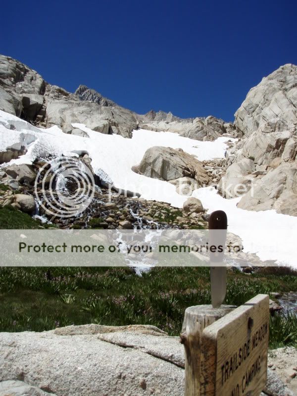
So here are some pics!
Map of the Trail

View from the Visitors Center

Trail Head

Nowhere to go up up!


more coming....
We started the hike this past Thursday morning from Whitney Portal to our first camp four miles away and 2,280ft higher than we started. The camp was near Mirror Lake at elevation 10,640ft. Altitude sickness hit a few people, headaches and vomiting, but nothing major.
Our second camp was at Consultation Lake near Trail camp. Almost three miles from our first camp, and just under 1,300ft higher. Still a bit of altitude sickness among everyone, but less than the first camp.
From our camp at Consultation Lake we started for the summit on Saturday morning at 7:30am. Our camp was just under 12,000ft and 4.7 miles from the summit. We had to climb 2,400ft over those 4.7 miles. Not to mention that it starts off with about 99 switchbacks to ascend the mountain. The hike was TOUGH!
We reached the summit at about 1pm, 5.5 hours since we left. The view that welcomed us at the top was SPECTACULAR and well worth the daunting climb to get there. We stayed at the summit for about 30 minutes. We took tons of pictures, signed the log, and took a much needed rest for food and water.
The climb off the summit went much quicker, I think we did it in about 3.5 hours. We got back to camp, had dinner, and went to bed while the sun was still up.
Sunday we packed up camp and headed down the mountain back to Whitney Portal. We loaded up the vehicles and headed down to Lone Pine for burgers and milkshakes before heading home.
It was a great trip. I am very glad I did it, but I'm not too sure I'd be up for doing it again. Altitude just sucks.
So here are some pics!
Map of the Trail
View from the Visitors Center
Trail Head
Nowhere to go up up!
more coming....


 awesome pics Christian.. looks like a blast.. i have always wanted to climb Mt. Whitney.. one of these these days the misses and I are going to have to give it a go..
")