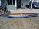
Paddling into 2013

You know you are on a roll when you can check off ... river cooperating and the weather maybe? starting to come onside, not to mention rod, reel and lures. The bass are halfway to the frypan. You do mean smallmouth bass? or ... As for work, responsibilities and vet costs - definitely not so much fun.

It was around 40F here overnight, presently 62F. The river has receded but is still flowing high and strong. The belted kingfisher is yapping staccato up and down the river, very in-your-face, and I cannot imagine where he is taking his dinner with the water so high.

The road and bridge are both now dry, somewhat repaired and passable compared to earlier pics taken during the flood.

IMG_8351POSTFLOODROAD500MED_zps4fae8ee1.jpg


IMG_8350POSTFLOODBRIDGEFULLON500MED_zpsf08e8712.jpg


IMG_8348POSTFLOODBRIDGEFROMRIVER500MED_zpsb84a2231.jpg


Good sale ... now for the PFD? On the main free classified website here, I have had good luck selling and soon my old and excess gear is going that way.
Failing sale, it will go to the local fundraiser flea market. There is little any discerning camper/paddler would be caught willingly with, alive ... or dead! But, this is also true in great part of the gear I presently use. I do have a list of wants should my sales turn up any cash and plan to dodge responsibilities as best as I am able.


Good luck with the PFD hunt. If it must be done, floating face up is best IMHO.
 
Yes, smallmouth bass. I also catch bream and sometimes crappie, but the smallmouth are the prime targets for my fishing.

35bdn5z.jpg


I often get a full stringer of mixed bag fish but usually let them go at the end of my trip if they are still in good shape.

I just went to my local Craigslist to see if I could find an appropriate PFD and (your fault) found this instead:

1zgey49.jpg
o73keg.jpg


A factory display card of 27 roostertails for fifty bucks. Plus eight other cards. I'm hoping now that the guy won't answer my email offer. That was half my PFD money!

Glad your river has gone down and the roads and bridges are repaired. I am wondering what trees and gravel bars got moved on my river. Luckily though my outfitter has chainsaws and airboats to clear the channels before he sends out his rental canoes. Already today the river has doubled in volume to 2070 CFS and 5.65 feet on the gauge.
 
Last edited:
Well, you said you could make do with the old PFD and how could you pass on those flash and dazzle lures? I am sure they will earn their keep by filling your freezer with more just like in the pic above! So, in fact, they are an economy. Congratulate yourself on being so penny-wise :rolleyes:

Re: your outfitter clearing the channels. Yes, that makes sense in light of the business. I think the flood has seriously 'lowered' one large overhanging maple here that will need the attention of a chainsaw when the water drops to normal. It certainly has picked up some large debris in upper branches that are still in the current.
 
Seller sold the lures locally so I am off the hook there. Guess I'll have to waste the money elsewhere. I do have a list. And the river is still rising so I'll just plan of going next weekend instead of tomorrow.

ETA: 3,750 cubic feet per second this Sunday morning after yesterday and last night's thunderstorms. Looks to have topped out at over 7 1/2 feet on the gauge. No Sunday paddle this week.
 
Last edited:
Surely the river level must be looking a lot more promising now? After all, it can only rain for so long. Right?

Just thought another post to a thread begun in 2013 was appropriate for the sub-forum :rolleyes:

Sad to report the maple at the river will be a goner, undermined by the flood. This is the loss of the only shade tree on the south facing bank area for most of the day until very late afternoon. Some replacement plantings or shoring up will be in order to maintain the bank. Any ideas are welcome. Budget and person-power are limited.

Since this was the '100 year flood', I don't expect to be around for the next one!

After

DSCF0587FALLENMAPLE500MED_zpsd0b307e8.jpg


Before

IMG_5582MAPLEFALL500MED_zpsd8dc555a.jpg


Shady maple from kayak on river. You will be missed ... a lot

IMG_4874TALDEZONTREE500MED_zps99ca45e5.jpg
 
Last edited:
Surely the river level must be looking a lot more promising now? After all, it can only rain for so long. Right?

Just thought another post to a thread begun in 2013 was appropriate for the sub-forum :rolleyes:

Sad to report the maple at the river will be a goner, undermined by the flood. This is the loss of the only shade tree on the south facing bank area for most of the day until very late afternoon. Some replacement plantings or shoring up will be in order to maintain the bank. Any ideas are welcome. Budget and person-power are limited.

Yes, the river is dropping. This last rain took it up to 3,950 cubic feet per minute and 7.8 feet on the gauge, but it has since dropped back to 4 1/2 feet on the gauge, decent canoeing level. However the forecast for the rest of this week is not great:


Thursday - 50% Chance Thunderstorms
Thursday Night - 50% Chance Thunderstorms
Friday - 80% Chance Showers
Friday Night - 80% Chance Showers
Saturday - 30% Chance Showers
Saturday Night - 30% Chance Showers
Sunday - 30% Chance Showers

It's just the way our weather rolls this time of year. Unfortunately, we are having warm sunny days early in the week and rain before and on the weekends. The cycle could be sunny weekends, but no. Still the sunny weekdays allow me to work and pay bills.

Yeah, a new member is going back through two year old threads and bumping them. It is just what some new members do, not realizing how annoying it can be to others.

Yep, it is the life cycle of riverbank trees. For the opportunity to have easy access to water year after year, they often pay with shortened lives due to bank erosion. Likely that bank would have caved long before now had it not been for the maple's root system. And a part of it may yet survive to provide shade. Altered no doubt, but shade still. I have no good suggestions on stream stabilization in your area. You might inquire with a government agency about it. They might even provide you with a few seedlings.
 
My son's new addition to the quiver.:thumbup:

Congrats to him on the Wildfire! I don't need to ask if he found a great deal on it.

Here is a video from my Arkansas buds from last Saturday running the upper Richland creek, and you can see why I have been off my local river these past weekends.

[video=vimeo;65012872]http://vimeo.com/65012872[/video]
 
Codger_64;12151158]Congrats to him on the Wildfire! I don't need to ask if he found a great deal on it.

A good deal would be an understatement. Needs to be re-railed, but it's usable. I might be able to manage the repairs.;)
 
Since it may have been one you built in the first place? That is one sweet handling boat. I only got to paddle it around at a demo day once in wind and a high chop, but it was very responsive.
 
It's a 95, I might have.
Since it may have been one you built in the first place? That is one sweet handling boat. I only got to paddle it around at a demo day once in wind and a high chop, but it was very responsive.
 
You piqued my curiosity and I have been surfing around to find the story on Bell. It seems that the new owners of Bell Canoe WOrks have ceased production and Ted Bell has gotten back into the biz on a limited basis. The three (now) classic designs, Flashfire, Wildfire and Starfire were bought and now produced by Colden Canoes.

http://coldencanoe.com/wildfire.html

So they are back in production, though not by either Bell company or Placid Boatworks. Still, at three grand, out of my league. I also did not know that they were David Yost designs. That does make sense though.
 
This past Monday, while most of us were working and a few were in school, some friends slipped off to the Buffalo National River to float the upper section, Boxley to Ponca which is not usually floatable later in the year. The low water bridge where they take out is the primary launch site for much of the year until the dog days make even that next section more of a drag than a float. There is no music with their GoPro video and the wind and "whoops" make it annoying, so que up your favorite music to accompany their trip.

[video=vimeo;65459998]http://vimeo.com/65459998[/video]
 
As expected, aced off the river again today. The 2 1/2" of rain we had Friday night and Saturday bumped the river back up to 4,100 cubic feet per second (246,000 cubic feet per minute) of discharge and 8.05 feet on the gauge. Not good for canoeing or fishing. My closer river, the Beech RIver, is well out of it's banks and churning. It doesn't have the rock and gravel bottom of the Buffalo (Tennessee) River, so it is very turbid. Oh well. That gives me another week to prepare. Maybe next weekend will be better. This makes four weeks in a row that late week rains put the river up too high for a safe trip. I bet the local outfitters are counting their revenue losses. They aren't giving updates and answering inquiries on their facebook pages. April 1st is usually the beggining of their rental season.
 
Lots of rain in middle and east Tennessee yesterday and moving eastward slowly. I measured 5.6" from yesterday (on my deck) until the rain stopped this morning. That is a lot of rain and it was mostly just a drizzle the whole time.

The Elk River (another canoe hotspot for casual days on the river) is spilling and won't be passable for most canoeists until they move this extra water downstream.
 
I believe that gauge is at the Hwy 64 bridge about a mile from I-24. It is upstream from the Tims Ford lake. They will be moving the water downstream for the next week as I believe the pool levels were pretty much raised to summer levels already. That is a lot of water for there. If the gauge is where the map shows, then there is a whole lot more water flowing into the lake right now.

You can see on the graph that the last big rain the discharge hit as much as 7,000 cubic feet per second. If the rainfall is close to what I measured, the flow rate is going to be moving up up up.

Here is a link to a common kayaking location on the Tellico River in the Blue Ridge Mountains of East Tennessee. It is pretty much over the top of the gauge right now and showing something like 4820 cubic feet per second. It is fishable for trout when the flow depth is under about 3 feet, 2 is better. http://waterdata.usgs.gov/tn/nwis/u...13-04-28&end_date=2013-05-05&site_no=03518500
 
Last edited:
Took the canoe out for the second time this season. First was with the scouts on the lake. No pics.

The weather was warm this Saturday. I loaded up the boys and wife, and tried a spot that is normally a little slow moving spot.

The lake in my area drains out through two spillways into an area known as the Pot Holes reservoir. (it is a great area for paddling, fishing and camping).

Last year this spot was about 25' or less from bank to bank. We paddled upstream and then floated back down when we got hot.

Yesterday, the spot was maybe 100 or 200 yards across?

Last year:


This year! Exact same spot!


I took Jake to the river today (Tennessee River) and let him swim. He swam at the park camp sites and roads that were under water. I didn't even take a canoe. I did take the fishing gear and bought a license, but there was no need in even getting it out of the truck and rigging a line.
 
I scored a used 14' We-No-Nah Vagabond solo in Kevlar this weekend as my 60 yr old knees are getting harder and harder to bend into a kayak. Paddled it yesterday. My first Kevlar. Incredibly light and responsive. Taking a little getting used to after 30+ yrs of kayaks. Actually spent a couple of comfortable couple of hours out and caught a couple of smallmouths.Feels good to be back on the water!--KV
 
Back
Top