Great weather for a walk today, overcast and cool when I started out, then the sun came out a bit later. I walked 6 miles on the trail, covering miles 14 through 17. Curiously, the mile 15 marker was missing. I’m almost certain there was one before — when Eleanor and I did the whole trail several years ago, I marked the location of each mile marker on Google maps — but when I got to the place it should have been, it wasn’t there.
Just past the mile 14 marker, the trail leaves Hennepin County and entered Carver County.
Today’s section of trail took me around the north shore of Lake Waconia.
Kind of strange to see graffiti like this out here. It’s not exactly the middle of nowhere, but there’s not much around, either.
There’s a winery just north of the lake, not far off the trail. I haven’t been there before, but I think Julie has been to a couple events there. You can’t see most of it from the trail (too many trees), but you do walk by some of the vineyards.
I’m not a wine-making expert, but I believe the wacky waving inflatable arm-flailing tube man technique dates back to some of the oldest European vineyards.


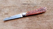
Another small trestle bridge along the trail provided a good place to stop for some knife pics. I had my Afzelia Burl Albers Lamb with me.


